Temperatures that reached the 60-degree mark in parts of the Hudson Valley on Wednesday will prove to be the calm before the storm.
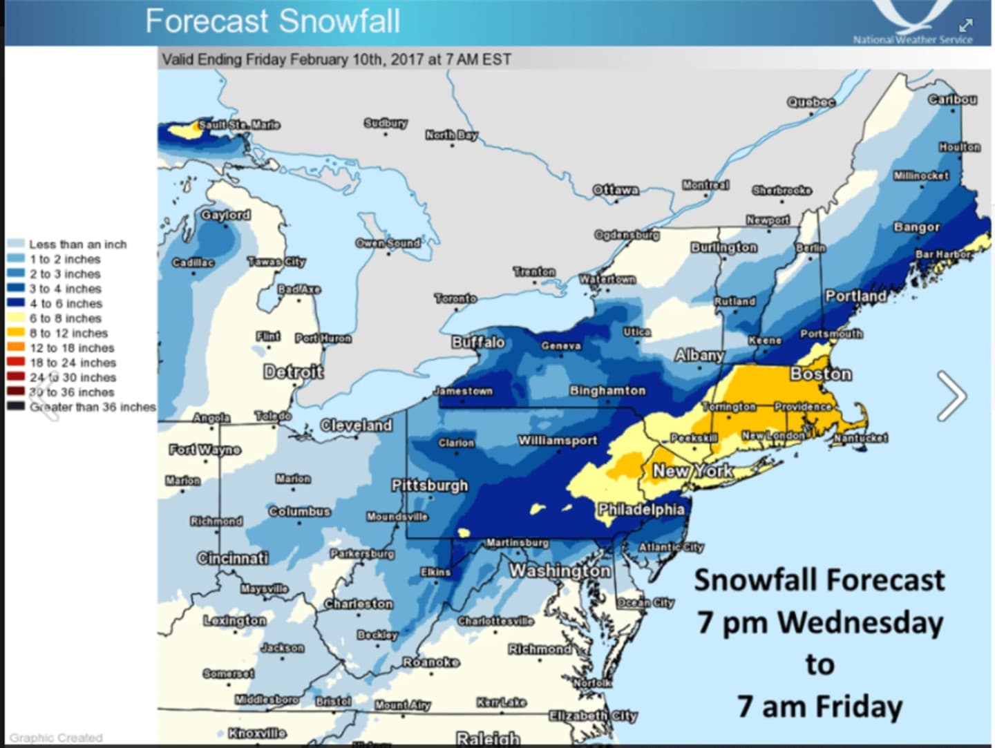
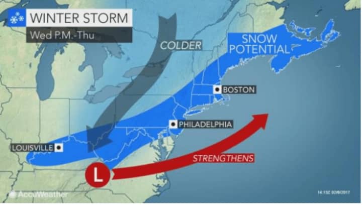
In this case, a major winter storm that will arrive in the area overnight and bring as much as a foot of snowfall accumulation along with hazardous travel and poor visibility that may drop to 1/4 of a mile at times.
In addition, there will be blowing and drifting snow during a day in which the high temperature struggles to reach 30 degrees with a wind-chill factor making it feel like it's in the teens.
Snowfall rates of 2 to 4 inches per hour are possible during the late morning and early afternoon Thursday, according to the National Weather Service.
Snowfall will arrive sometime after midnight with an accumulation of 1 to 3 inches possible overnight.
Thursday calls for snow becoming heavy late in the morning and that heavy snow continuing through mid-afternoon with temperatures dipping into the mid-20s by 5 p.m.
The snow is expected taper off late in the afternoon Thursday and wrap up by around 7 o'clock in the evening with temperatures continuing their drop to the mid-teens.
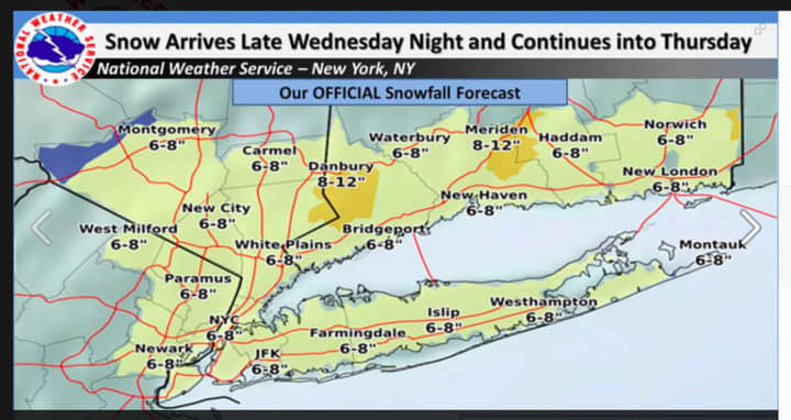
Much of the Hudson Valley will see between 8 and 12 inches of total accumulation, with locally heavier amounts possible, the National Weather Service said.
Sunshine returns to the area Friday, but the cold air continues as the high will only be in the upper 20s
Areas farther north, including Putnam and Dutchess, could see some light snow before 8 a.m. Saturday on a cloudy day with warmer temperatures reaching a high near 40, there's a chance of a mix of snow and rain is Sunday.
State Police are reminding motorist to use extreme caution and to avoid all unnecessary travel.
Check back to Daily Voice for updates.
Click here to follow Daily Voice Rye and receive free news updates.