Find Your Daily Voice
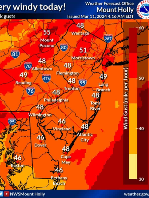
50 MPH Winds Knock Power To More Than 30K New Jersey Residents
Wind gusts nearing 50 miles per hour left thousands of New Jersey residents without power Monday, March 11.
According to the National Weather Service, winds are expected to die down in the evening with a wind advisory in effect until 11 p.m.
Skies will be mostly cloudy with a high near 50.
As of 4:15 p.m., the following areas did not have power:
JCP&L:
Hunterdon County: 4,264 without power mostly in Bethlehem, Glen Gardner, Hampton, Hampton, High Bridge, Lebanon, Readington
Middlesex County: 8,359 without power mostly in Monroe Township
Morris County: 10,049 mostly in…
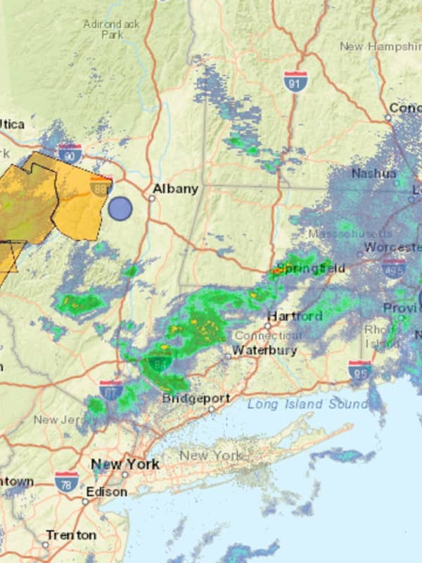
Coastal Flooding, Wind Expected From Pre-Valentine's Day Winter Storm On Jersey Shore
While many parts of the Jersey Shore won't see snow, a winter storm is expected to bring some issues right before Valentine's Day, forecasters said.
According to the National Weather Service, moderate coastal flooding is forecasted from Perth Amboy to Cape May on Tuesday, Feb. 13. Minor flooding coastal flooding is expected along the Delaware Bay and Delaware River.
Parts of Burlington, Cumberland, Monmouth, Ocean, and Salem counties are expected to get about an inch of snow. While inland Atlantic County could see some snow, the coast and Cape May County aren't forecasted to receive any acc…
Harford County Public Schools Closing Three Hours Early On Tuesday Due To Expected Storm
With another round of wintry weather expected to roll through the region, some schools are taking precautions and will be dismissing students and staff early.
The Harford County Public Schools and offices will be closing three hours early on Tuesday, Jan. 9, and there will be no afterschool activities or daycare, according to the district.
Due to the forecasted high impact storm, Harford County Public Schools schools and offices will close 3 hours early tomorrow, Tuesday, January 9, 2024. No afterschool activities or afterschool daycare, Tuesday, January 9, 2024. 2nd shift custodians are…
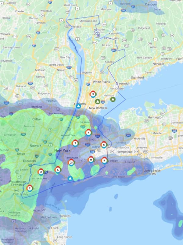
Strong Winds Topple Tree Limbs, Cause Power Outages On Long Island
PSEG Long Island utility crews are working to repair power outages in Nassau and Suffolk counties.
Hundreds on Long Island are without power as whipping winds with gusts up to 50 mph are toppling tree limbs and power lines.
According to PSEG Long Island, as of 11:45 a.m. on Monday, March 29, crews are working to repair 37 active outages that were affecting 157 of the company’s customers.
In Suffolk, 92 customers are without power, including 32 in Smithtown, followed by Babylon (27), Brookhaven (14), Islip (10), and Southold (nine). In Nassau, Hemsptead (46) was reporting the most outages, …
Wind Gusts Up To 50 MPH Knock Out Power In Hudson Valley
Hundreds in the Hudson Valley are now without power as high winds whip through the area.
A Wind Advisory is in effect until 4 p.m. Monday, March 29.
Related story - Here's Timing For Heavy Rain, Thunderstorms, Wind Gusts Up To 50 MPH That Could Cause Outages
As of around 10 a.m. on Monday, Con Edison was still reporting nine active outages that were impacting customers in Bedford, Cortlandt, Greenburgh, Mount Vernon, New Castle, Scarsdale, and Yonkers.
Farther north, Central Hudson is working to restore power to 1,778 of its customers as crews work to respond to 65 outages.
Ulster …