Find Your Daily Voice
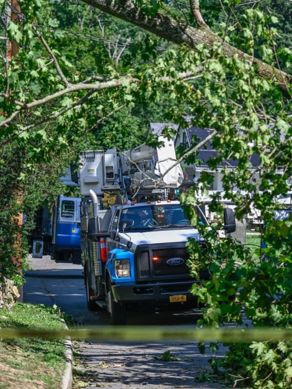
Hundreds In Westchester Left Without Power During Heatwave
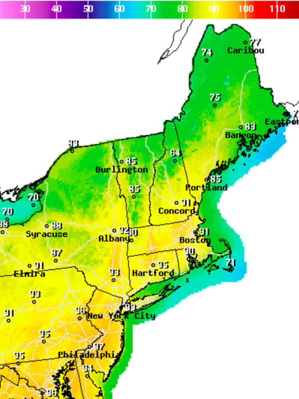
The heatwave that has been crushing the East Coast left hundreds in Westchester without power as crews scrambled to make repairs as some systems became overwhelmed.
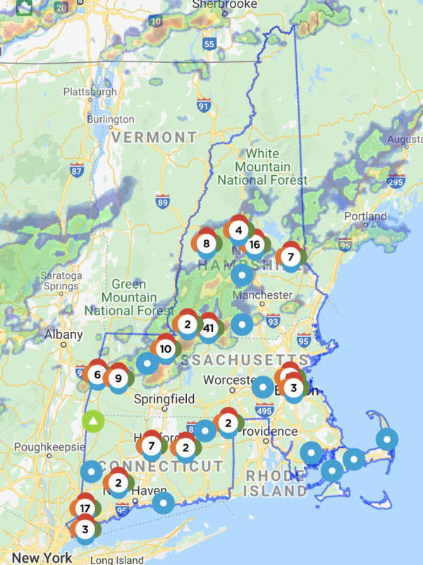
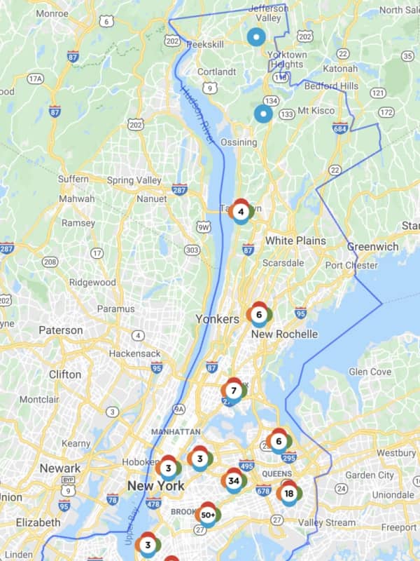
As of Wednesday afternoon, June 30, Con Edison was reporting 13 active outages, which were impacting 556 of the company’s 360,045 customers in Westchester.
In total, Con Edison was reporting 177 active outages that were impacting 3,502 of their 3,535,450 customers.
The bulk of the outages were reported in Yonkers (338 customers reporting outages), Tarrytown (193), and Yorktown (19). Other outages were reported in Bronxville, Gr…