
A heat wave is defined as three straight days in which the high temperature hits 90 degrees or above.
High temperatures on Wednesday, July 26 will generally be in the upper 80s to around the 90-degree mark with hazy sunshine most of the day, the National Weather Service says.
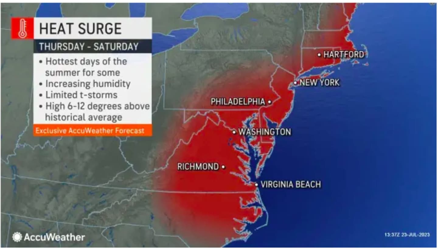
The dangerous heat will really kick in Thursday, July 27 as humidity increases, making temperatures in the low to mid-90s feel like it's 100 degrees or more. (See the first image above from AccuWeather.com.)
It will be partly sunny with a slight chance for scattered afternoon storms. The storm chance will increase at night. Some of the storms could produce small hail and gusty winds.
Friday, July 28 could be the warmest day of the week -- and the year -- as the high temperature approaches the 100-degree mark in much of the area, with partly sunny skies. Possible storms in the afternoon and evening could cool things off a bit.
"There is a chance that the heat index (the combination of the temperature and humidity) may reach 105 on Friday," the National Weather Service said in a statement.
It will be partly sunny on Saturday, July 29 with a high temperature of 90 degrees or higher.
Look for scattered afternoon and evening showers and storms as a cold front pushes through that will bring a halt to the heat wave.
Sunday, July 30 will be pleasant and comfortable with mostly sunny skies and a high temperature in the low 80s.
The high temperature is expected to stay in the low 80s, or slightly lower, the following few days with less humidity. (Click on the second image above.)
Check back to Daily Voice for updates.
Click here to follow Daily Voice Rye and receive free news updates.